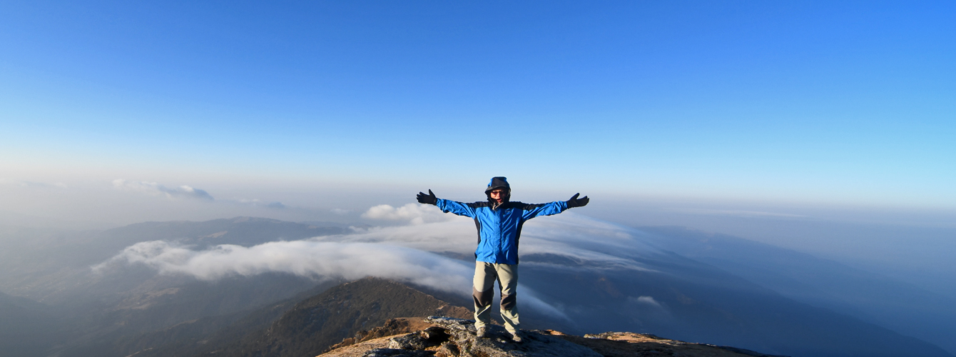
Although Pikey Peak is an excellent trekking destination in the lower part of the Solukhumbu district, it remains relatively unknown due to a lack of publicity. In an effort to support its promotion, I have written a travel diary about the area for the first time in my life. My aim is to raise awareness about Pikey Peak and the region, as it holds great significance for the local residents who consider it an important landmark and even worship it as a local deity due to its status as the highest mountain in the area.
Pikey Peak is situated in the southwestern part of the Solukhumbu district, bordering the Ramechhap and Okhaldhunga districts. Growing up at the foot of Pikey Peak, I have always been familiar with its presence, standing proudly on the northern side of my village. Despite being a popular tourist destination in the lower Solukhumbu district, the region’s tourism infrastructure has not been well-developed due to the Maoist conflict and the subsequent political transition period. However, the local government and the people have been actively promoting tourism, resulting in the construction of some tea houses and the repair of old paths.
The Pikey Peak area offers trekking opportunities ranging from 5 to 10/11 days. It is an ideal choice for those who are short on time or have concerns about high altitudes, yet still want to witness the majestic Himalayan views, including Mt. Everest, and experience the charm of rural Nepali life. This trek is more than just another Himalayan adventure. It provides a less crowded route, breathtaking scenery, and an immersive local lifestyle. Choosing the Pikey Peak trek will undoubtedly be the highlight of your trekking experience in Nepal, offering a truly memorable adventure holiday. I hope this travel journal inspires you to start on this trek and provides you with enough information about the Pikey Peak Trekking experience.
The First Day Pikey Peak
Kathmandu to Dhap (2932 m.)
Time: 8 hours
Distance: 235km Jeep journey
Date: 28-February-2021
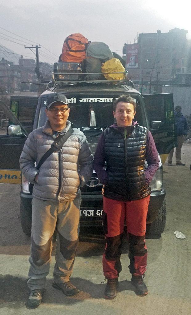
Our journey to Pikey Peak begins at Chabahil, where we hop on a local Jeep with other passengers. If you prefer, you can also arrange private transport, which is more convenient and can pick you up from your location. The local Jeeps are small and meant for seven passengers, but they often squeeze in nine, resulting in cramped and uncomfortable seating. Although bus services are available, they take longer due to frequent stops along the way, so most people prefer private reserved transport for comfort and convenience.
We set off early in the morning to avoid traffic and quickly left Kathmandu City, heading east. After about an hour’s drive, we reached Dhulikhel, a beautiful hill station located to the east of the Kathmandu valley. From there, you can enjoy stunning views of Nepal’s highest Himalayan ranges and rural villages.
The BP Highway, also known as the Dhulikhel-Bardibas Highway, was constructed with financial and technical support from the Japanese government. It is one of Nepal’s most scenic roads. The winding narrow highway follows the beautiful hill terraces and offers breathtaking mountain views before reaching Bhakundebesi and the Roshi River valley. As we ventured deeper into the river valley, the road became less winding, and we passed through picturesque villages, farmland, and towering cliffs, reaching Ghurmi.
During road journeys in Nepal, drivers often stop for food. On our journey, our driver stopped the Jeep at Jhagajholi for breakfast. It is an unwritten rule that most public transport drivers stop at the same place each time, and we have to eat wherever they stop. This allows the drivers to save their food allowance since their salary is not as generous as it should be. Stopping at the same place every time helps them save their food allowance and maybe earn an extra commission. The typical roadside restaurants serve similar pre-cooked breakfast items, such as chapati, potato/chickpea or pea curry, boiled eggs, pakoda, fried bread, rice pudding, and fried potatoes. The food is usually tasty but a bit spicy, so you have to inquire before ordering.
The Roshi River merges with the Sunkoshi River at Nepalthok. Sunkoshi means “river of gold” and originates from the mountains of Tibet, passing through Nyalam into Nepal. This transborder river is one of Nepal’s main rivers and is called the Saptakoshi (the largest river in Nepal) as it flows down to Terai and merges with other large rivers. Sunkoshi contributes around 44% of the total water of Saptakoshi.
The road stays on the south side of Sunkoshi and follows the river to the east. The climate is tropical, and from April to September, it gets very hot. Public transport has no air conditioning, so keeping the windows open is the only way to stay cool. From Khurkot, we left the BP highway and took the Khurkot Ghurmi Madhya Pahadi Highway. The road is wider but rougher and crosses several landslide areas. Nonetheless, it is much more comfortable than many of our mountain roads. We stopped in Narayan Khola for lunch and had pre-cooked dal bhat, which is the main staple diet for Nepalis. On the road, pre-cooked dal bhat is always the best and quickest option in Nepal. You may find other basic items as well, but they may not taste as you expect and may take longer to prepare.
About 15 kilometers ahead of Narayan Khola lies a small business town called Ghurmi Bazaar, a name I often heard as a child. My parents used to travel through there to Katahari once or twice a year to purchase necessary goods like salt. The journey back and forth would take around seven or eight days. Since then, the place has undergone significant changes. Previously, the houses were made of bamboo thatches, and the alleys were narrow. However, many concrete buildings have been constructed already, and the roads have widened. There, we crossed the Sunkoshi River.
After crossing Sunkoshi at Ghurmi, we ascend via Harakpur. Although the road is narrow and winding, it’s clean and less crowded. As we climb higher, the view widens, and the scenery becomes more beautiful. The Okhaldhunga-Solu Highway passes through charming villages, terraced farmlands, meadows, and forested areas. We ascend around 2500m to reach our destination, Dhap, transitioning from the tropical climate to the subalpine zone. It’s recommended to carry warm clothes with you.
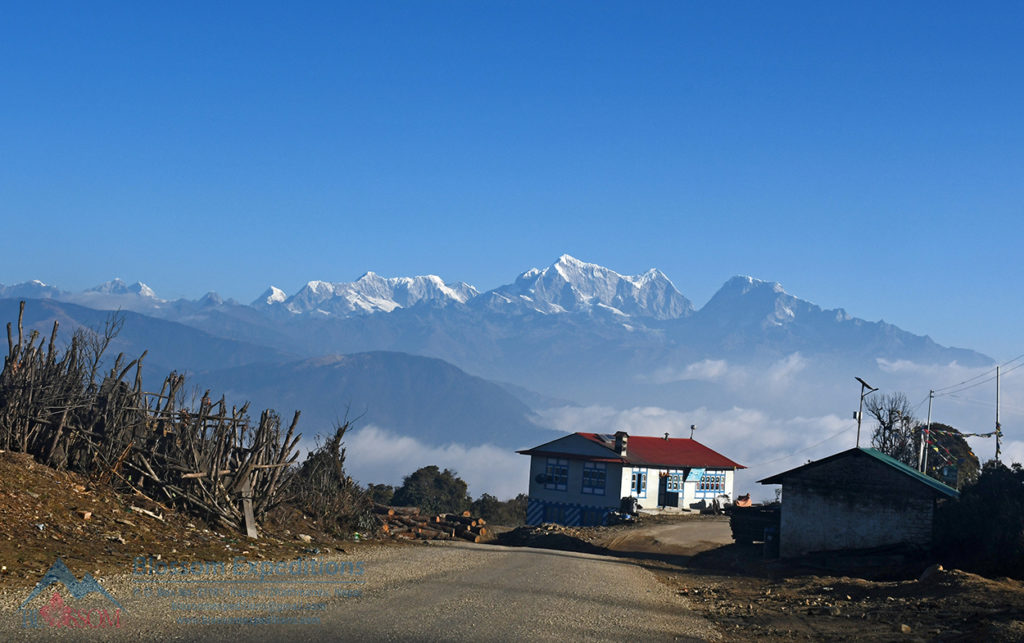
Just before reaching Dhap, the jeep stopped at Thade Bazzar for tea and coffee. There, one can taste salt butter tea with a bit of roasted barley flour, a popular hot drink in the mountain region of Nepal. Thade Bazzar is an old Magar village situated on top of the ridge at an altitude of more than 2,800m. The temperature is much cooler, and you may need to put on an extra layer.
Dhap is located on the border of Solukhumbu and Okhaldhung districts and has an elevation of 2932m above sea level. The area mainly belongs to Magar people from Bagam and Jantarkhani villages. It is their summer pasture and potato field, locally called Bugbari.
The term “Bug” means a mound of soil, and “Bari” means farm. The process of making Bugbari is quite long. In the high eastern mountain areas, the land is left for 2-3 years without farming to let the grass grow. Later, the sod is dug up and dried in the sun. After drying, a fire is built and covered with sods, allowing it to burn. Everything turns to ashes, including the soil. They let it cool down for a few days, then plant potatoes in the ash and cover them with fresh soil. This is a purely organic way of farming potatoes, without the use of man-made fertilizers. It is a typical method of potato farming in the eastern mountain areas.
The Dhap area is usually cold, windy, and foggy later in the day. This lower Solukhumbu region has great tourism potential. The location is wonderful, making it the perfect place to begin an adventure. From here, you can see spectacular mountain views and sunrises, as well as a great number of picturesque villages and beautiful river valleys. Currently, at least six hotels have been opened in Dhap, and as you go about a kilometer down to Patale Bazzar, more guest houses are available. Dhap is an excellent place to spend the night and enjoy the view.
The second Day Pikey Peak
Dhap to Jhapre (2820m)
Time 3 hours 30 minutes
Distance: Approx. 10.30km Trekking
Date: 1-March-2021
On the second day, we woke up early and grabbed a cup of tea before hiking to Changesthan Temple, which took about 15-20 minutes. The temple is situated at an altitude of around 3,000 meters.
Legend has it that in ancient times, the Chauri (a crossbreed between a yak and a cow) stopped giving milk, so the herdsman secretly followed the cow and saw it spilling milk on the ground at the top of the hill. He started believing that place to be the home of the deity. From that day onwards, the locals of the area started worshipping the goddess as Change Mai/Jantari Mai, also known as Changesthan. A big fair is held here on the day of Janai Purnima, which falls on the full moon day of August-September according to the English calendar.
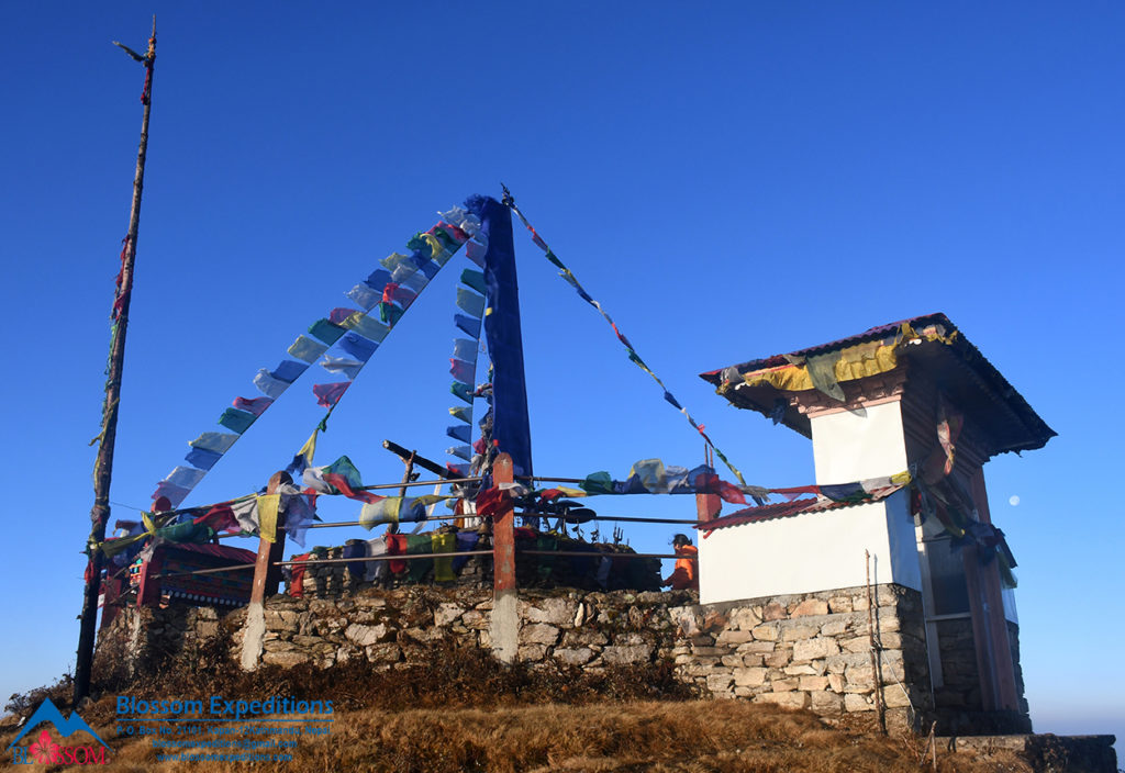
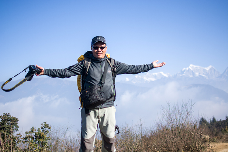
We enjoyed a stunning panoramic view of the Himalayas, including Mount Everest, Makalu, Numbur/Karyalung Himal, and Gaurishankar mountain ranges, as well as a beautiful sunrise. We also had the opportunity to admire the scenic beauty of the surrounding valleys in the southern part of Pikey Peak. That morning was truly unforgettable for all of us.
After spending about an hour at Changesthan, we returned to our lodge. The local chapati bread, chickpea-potato curry, and boiled eggs made for a great breakfast combination, but there were other options available as well.
Our destination for the day was Jhapre, which was only a short 4 to 5-hour walk covering about 11km. Initially, we followed the road to Tapting towards the north, but the unpaved dirt road wasn’t crowded and felt more like a wide-open hiking path. After about half an hour of fairly level walking, we started descending through the forested area. While descending, we had the option to skip the road and follow the old walking path to the little village of Singane. The scenery was breathtaking throughout the day, with views of the mountains, the Sisakhola Valley, and the Jantarkhani areas.
We took a tea break at Singane, where there are a few tea shops, and we bought some snacks for later. The unpaved motor road gradually goes uphill, and after about half an hour’s climb, we encountered two paths. It was important not to take the right path but instead climb straight ahead. We occasionally took an old shortcut walking trail.
The area consisted of mixed forests and open farms/pastures. After about an hour of ascent, we reached the ridge of Phokte Danda and then followed an easy-level path to Tadpani Bhanjhyang. Trekking through the forests of rhododendrons, brown oaks, and pines, as well as open pastures, was very pleasant and enjoyable, along with the view of the magnificent Himalayas. We walked slowly at a steady pace, talking and walking uphill at our convenience. The weather was perfect for trekking, with a light breeze and the sun not shining too strongly.
Continuing to follow the ridge, we reached the small village of Jhapre after a short climb. There were a few tea shops and lodges along the way from Tadpani to Jhapre, and you could spend the night in those places instead of Jhapre too.
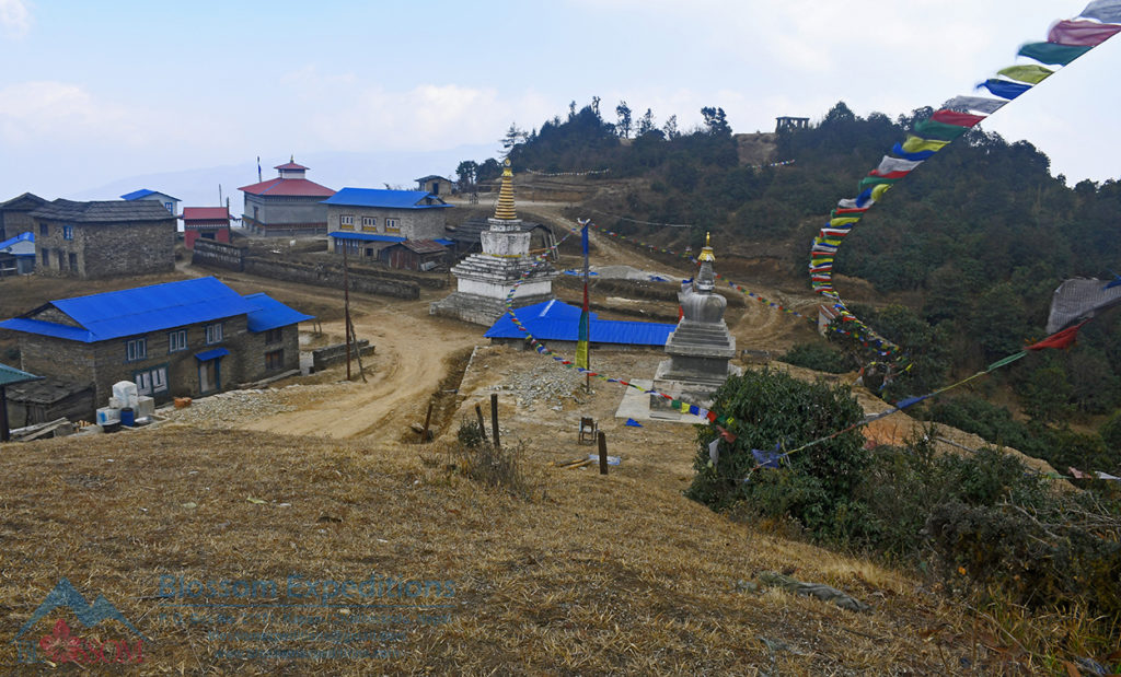
The small village of Jhapre is located on top of the hill and has houses a monastery. The Jhapre Monastery (Gomba) is the main religious center for the people of the Tapting area. It was founded by the late Mr. Pasang Kaji Sherpa and his best friend, the late Rinpoche Tenji Lama, on April 28, 1986. Although it is not an old monastery, it holds great importance, and the people of this region have strong faith in it. The great Guru Tenji Lama of this monastery passed away on July 22, 2002, but he has been reincarnated and is currently studying in India. His son, Ang Babu Lama, is taking care of the monastery these days. The monastery, along with old Buddhist stupas, and Mani walls, presents a beautiful sight. The monastery has been rebuilt in recent years, but the exterior still needs to be painted. The interior of the monastery is beautifully decorated with statues, wall paintings, Thangkas, and old religious texts.
People in this region collect mountain bamboo grass, called Jhapra, to feed their animals. In the past, many people used to come here to gather Jhapra and rest in this place. Over time, the place became known as Jhapre after Jhapra. There are three main lodges and some tea shops, making it a suitable place to spend the night.
The afternoon weather wasn’t great; it was quite cloudy until late afternoon before clearing up down the valley. However, the view of the Shisa Khola Valley and villages became beautiful later in the day. Unfortunately, the mountains couldn’t be seen until the next morning. Nonetheless, you will be able to witness at least three of the world’s highest peaks, including Mt. Everest, Makalu, and Kanchenjunga, along with other neighboring mountains from there. Additionally, a lovely sunrise view awaits you in the morning from your lodge. You will experience the Buddhist culture, religion, and local food and enjoy the beauty of nature while staying there.
The Third Day Pikey Peak
Jhapre to Pike Base Camp (3640m)
Time 5 hours 30 minutes
Distance: Approximately 14km Trekking
Date: 2-March-2021
On the morning of the third day, we enjoyed the beautiful view of the majestic Himalayas and the sunrise just outside the lodge and monastery yard. Our destination for today was Pikey Base Camp, so it was best to leave early for the long day trek. Just after the Jhapre village, the path entered the forest of Rhododendrons, Himalayan Hemlocks, and Himalayan Firs. We were still following the dirt road, but occasionally, we skipped the road. Trekking through the peaceful forest, listening to birds chirping, on the wide-open path and meadows was truly a pleasant feeling. The gradual uphill trail led us towards Rakhop Danda. After about 45 minutes of trekking, we reached the large meadow. As we climbed higher, the view became wider and more spectacular. The view down the valley was captivating, and the Pikey Peak and Numbur Himal to the north looked stunning.
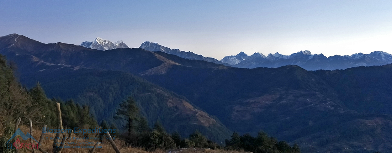
Although the path was a bit steep, we didn’t feel any difficulty because of the breathtaking scenery around us. At the end of the meadow and just below Rakhop Danda, there was a tea shop. Next to the tea shop, there were two paths. We took the right path and continued climbing towards Rakhop Danda until we reached the top. However, if you have time and are thinking of spending a night at Bhulbhule, you can take the left path to Tolu Monastery. This will add an extra one-and-a-half-hour walk, and later it connects with the main path on top of Rakhop Danda.
Now we were just above the tree line, following the grassy hills towards the north. The view was breathtaking on both sides of the hill. We could see the Annapurna and Manaslu Himalayan ranges to the Far West, Kanchenjunga to the Far East, as well as Makalu, Everest, Numbur Himal, and others. After an hour-long easy walk, we reached a place called Bhulbhule. There was a small lodge where we stopped for tea/coffee and lunch. If you have time and want to split the journey into two easy days instead of one long day, then Bhulbhule would be a good choice. Bhulbhule is surrounded by a Rhododendron forest. In the spring season, the place looks particularly beautiful because of the blossoms.
This area is always beautiful with Rhododendrons and other wildflowers blooming in spring, lush greenery, and plenty of wildflowers in summer, spectacular Himalayan views in autumn, snow, blue skies, and awesome mountain views in winter. Additionally, there are special features in the area, such as ancient Mani walls, stupas, Buddhist monasteries, local food, and local culture.
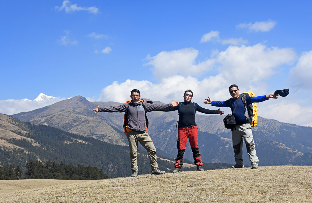
Currently, we were following Lhamje Ridge and passing by two centuries-old Mani Walls along the way. The intersection of the old trading trail to Jiri was just next to the last Mani wall. We trekked straight ahead and gradually ascended towards Boudha, where we saw a recently renovated Buddhist Stupa, Mani walls, tea shops, and some summer huts nearby. An almost level trail on the southern slope of the Chyapsa hill led east through the Rhododendron and Pine forest, where you may spot some wild animals and Daphe (Lophophorus), the national bird of Nepal. Unfortunately, we didn’t see one. The view of the southern valley of Shisakhola was amazing. In less than an hour’s trek, we reached Samshing Bhanjhyang, where there were some tea shops, making it a good place to stop for lunch or snacks. We stopped there for tea.
Samshing Bhanjhyang has a very long Mani Wall, considered one of the longest in this region. Many Mani walls can be seen between Dhap and Pikey Base Camp, believed to be 200-300 years old. From ancient times, Buddhist teachings have profoundly affected this special mountainous region of Nepal and continue to do so today. These historical, archaeological, cultural, and significantly important monuments help us promote both adventure and religious/cultural tourism in the region.
After passing the long Mani wall, a short, steep climb led to a resting point. From there, Pikey Base Camp was not far, and the trail was quite gradual. Pikey Peak Base was previously known as the Dairy. There was an old dairy established with the support of the Swiss government. Around 1950, the Swiss government established some cheese factories in the mountain regions of Nepal, and this is one of them. The Dairy produces Nak cheese, and during the summer season, the little cheese factory is quite active. From the base camp, we enjoyed the amazingly beautiful sunset view on the horizon, as well as the mountains to the west. If you have the energy, you can hike further up the hill and enjoy an even more dramatic view in the evening.
The Fourth Day Pikey Peak Trek
Pike Base Camp to Jasmane Bhanjhyang (3550m)
Time 4 hours
Distance: Approximately 4km Trekking
Date: 3-March-2021
Our destination for the fourth day was Jasmane Bhanjhyang, which we reached via Pike Peak (4065 meters). Our day typically started early in the morning. There were two options to reach Jasmane Bhanjhyang. One option was to return to the base camp from Pike Peak summit and take the lower trail through the Juniper and Rhododendron forest. The lower trail was short, with a gradual uphill section followed by a gradual downhill stretch to Jasmane Bhanjhyang. However, during the late autumn and winter seasons, the route could be challenging due to ice. The area remained in shadow, causing the streams and wet areas to freeze. Alternatively, we could descend directly from the top of Pike Peak.
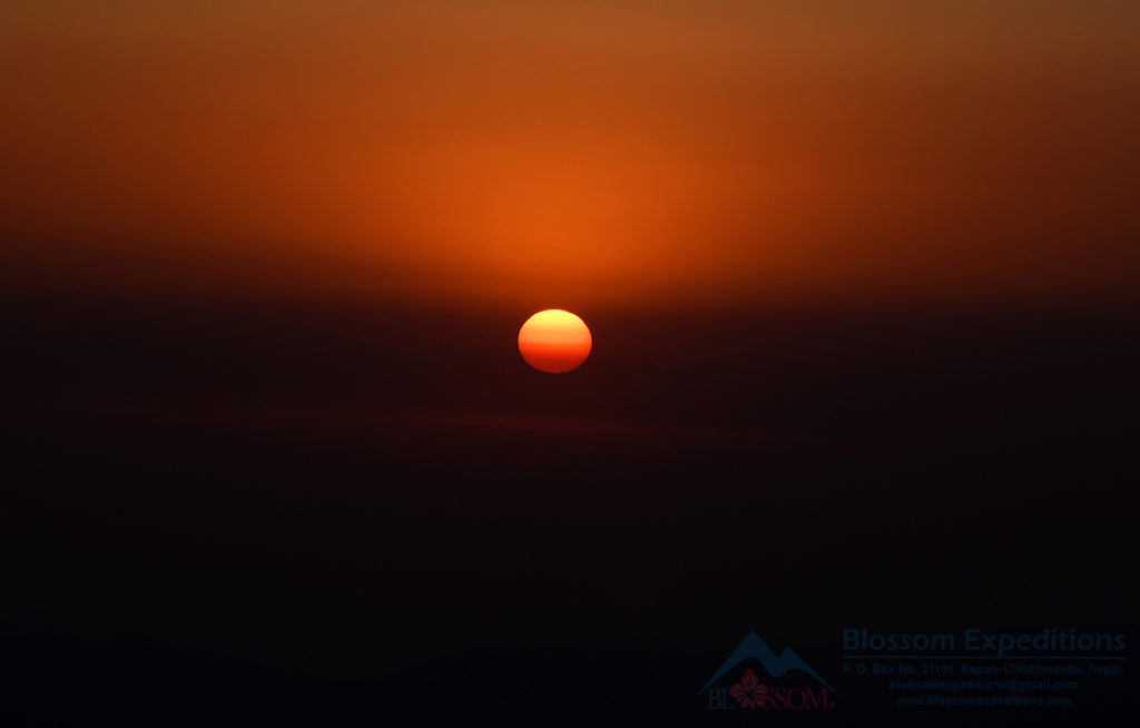
We chose the second option, waking up before 4 o’clock, enjoying a cup of coffee and tea, eating some food, and getting ready to climb Pike Peak at 5 o’clock. Getting up early in the morning was worth it to witness the beautiful sunrise view and the spectacular unobstructed sight of the majestic Himalayas. The climb was quite steep, and there were multiple routes to reach the peak. Regardless of the path we chose, the steepness remained the same. In some sections, we had to climb up stone steps. Trekking slowly and steadily helped us reach the top of Pike Peak on time.
There were two peaks called Gole Pikey and Chyawa Pikey, both of equal height. Most trekkers climbed Gole Pikey, while some ascended both. Before I started trekking, I had visited Pikey Peak 5-6 times. Here is some cultural background: once a year, there is a day called Ranke.
The local people believe that working or entering their farms is considered inauspicious on the day of Ranke. Therefore, on that particular day, they go to Pikey Peak to collect incense (Sunpati and Latte Dhupi). People from the Solukhumbu, Okhaldhunga, and Ramechhap districts gather around the Pikey area to gather the incense. It feels like a fair in a way. There is also a shrine dedicated to a deity on the south side of Chyawa Pikey. Some people visit the shrine to worship the deity. Many young boys and girls also visit to meet each other and understand each other’s feelings under the pretense of collecting incense. I went with my mother once or twice and later with friends. I still remember walking up and down the hill with my friends, playing a three-piece cassette player. Usually, the weather during Ranke is rainy, foggy, and very wet. But people don’t mind it. It is a time of reunion, meeting distant friends and relatives, and of course, indulging in celebration. So, it is a great day for the people of that region.
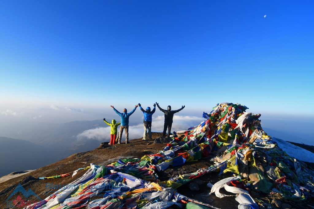
Climbing Pikey Peak (4065m) was the most rewarding part of the trip, and the view from the top was truly breathtaking. We forgot all the previous pains and difficulties and immersed ourselves in the amazing beauty of nature. On clear days, we could see six of the 14 highest mountains above 8,000m in the world, including Sagarmatha, Kanchenjunga, Makalu, Lhotse, Manaslu, and Annapurna. The 360-degree view from the top of Pikey Peak is probably one of the widest in Nepal. The view of the rolling hills to the south was just as spectacular as the white snow-capped mountains. The beautiful colors and warmth of the morning sun filled our minds with joy. The colorful prayer flags offered by Buddhist visitors fluttered in the wind, and when touched by the morning sunlight, created an unbelievable scene.
With this beautiful moment captured in our minds, we began to descend, following the southeast ridge of Gole Pikey to the small round Mani walls situated between Gole Pikey and Chyawa Pikey. From there, one could also climb Chyawa Pikey. Descending further, the path became slightly narrow, and the last part of the steep trail led through the Rhododendron forest to Jasmane Bhanjhyang. The one-and-a-half-hour downhill trek was comparatively more challenging than the previous days.
If you’re in a hurry and have a short time or if you’re feeling energetic, you can continue trekking to Junbesi on the same day. However, please note that it’s a long day of trekking, lasting around 10-11 hours. Alternatively, spending a night at Jasmane Bhanjhyang is a more sensible option and allows for an easier two-day trek. From there, you can also trek directly to Phaplu via Lhoding and Tamakhani in a single day. There are two good tea houses in this area where tourists can stay without any problems. Jasmane Bhanjhyang, previously known as Jasmare Bhanjhyang, derived its name from a person named Jas Bahadur who died while hunting. The locals used to refer to it as Jasmare Bhanjhyang (Jas dead Pass). Over time, Mani Walls were built, and the place eventually became known as Jasmane Bhanjhyang. Don’t miss the opportunity to take an exploratory walk around the area and spot wildlife such as Himalayan Thar, deer, blood pheasant, Lophophorus, and yaks.
The Fifth Day Pikey Peak
Jasmane Bhanjhyang to Junbesi (2700 m)
Time: 6 hours
Distance: Approximately 11km Trekking
Date: 4-March-2021
On our fifth day, we headed towards Junbesi. After breakfast, we began our journey with a steep uphill climb through Rhododendron and Juniper bushes towards Pambu Danda. The weather was not that good today, quite foggy, windy, and frosty as well. Along the way, we came across a left trail that connects to the old Jiri-Everest trek route via Lamjura.
We took the right path, and after about an hour or so, we reached Pambu Hill. Pambu Hilltop itself is a beautiful place with summer huts and offers the most dramatic view of Mt. Numbur, Khatang, and Karyalung, as well as Mt. Everest and other mountains. You can spend some time enjoying the scenery there. But today, we did not see much, just a glimpse of Numbur Himal. I took a couple of photos and continued our journey.
From Pambu Danda, the path took us through a magnificent forest of Rhododendrons, Himalayan Hemlock, and Himalayan Fir towards Upper Taktor. The large meadow, or summer pasture, was incredibly beautiful. The path then gradually led us to the popular Jiri-Everest trek route in Taktor. The beautiful Sherpa houses, wheat and potato fields, Buddhist Mani walls, and stupas are wonderful features of the Taktor Valley.
We continued our journey with a gentle downhill walk towards Junbesi village, which is located at an altitude of 2,700 meters above sea level and nestled in the lap of Mt. Numbur, Khatang, and Karyalung. Junbesi is one of the most picturesque Sherpa villages in the lower Solukhumbu region. Here, you can experience Sherpa culture and hospitality and visit the oldest monasteries in the Solukhumbu district, Buddhist Stupas, Mane Walls, and Kani (the village entrance).
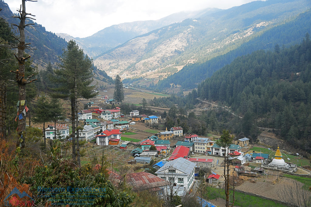
The traditional Sherpa village is definitely worth exploring. At the eastern end of the village, you’ll find a beautiful old Buddhist stupa and a beautifully painted Kani (village entrance). On the northern side of the village, you’ll see the magnificent and newly renovated yellow-roofed Gompa, which is the oldest in the region. Inside the Gompa, the huge statue of Amitabha Buddha, with statues of Chenrezig and Guru Rinpoche on either side, looks glorious. The piles of religious textbooks on the cupboard and the colorful and artistic Buddhist frescoes on the wall are truly captivating. These frescoes depict Buddha’s teachings, the biographies of Lord Buddha, stories of many great Buddhist gurus, and the life cycle of all living beings, showcasing the great importance of Himalayan Buddhism. Lastly, the well-set-up apple orchards, vegetable gardens, and farmlands add to the beauty of the Junbesi Valley, making it my favorite place in the lower Solukhumbu region.
The Sixth Day Pikey Peak
Junbesi -Thupten Choling Gumba- Junbesi-Salleri
Time: 4 hours
Distance 8km trekking and 16Km jeep Drive
Date: 5-March-2021
On our sixth and final day of trekking, we did a half-day excursion to Thupten Choling Monastery and then drove to Salleri. The Junbesi Valley, which leads to Thupten Choling Monastery, is a sacred valley in the lower Solukhumbu region. The route was gentle, following the Junbesi Khola. The valley scenery was absolutely incredible, displaying beautiful Sherpa villages, farmlands, pine forests, and houses. Along the way, we came across numerous long mani walls, stupas, and monasteries, adding to the flourishing presence of Buddhism in the valley. This walk is the most pleasant part of our trip.
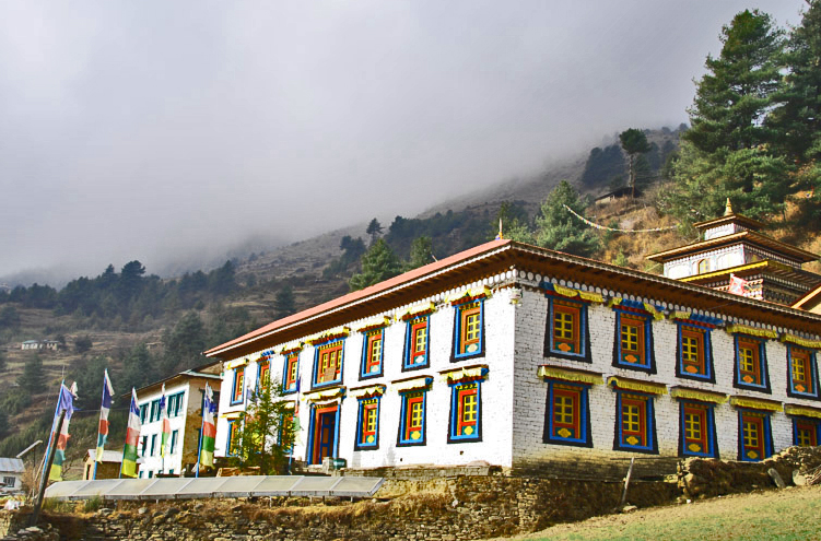
Thupten Choling Monastery is situated in the Solukhumbu district, east of Kathmandu, around 16km north of Phaplu Airport. It resembles a small city that lies in the foothills. The monastery houses over 800 nuns and some Lamas, making it the largest Buddhist religious center in the Solukhumbu district. It was established in 1960 by the late His Holiness Kabje Thrulshik Rinpoche. Following the annexation of Tibet by China in 1950, he and his followers fled Tibet and took refuge at Thame Monastery in Khumbu before eventually arriving at the Chiwang Monastery. Later, the Government of Nepal donated land above Junbesi where he established Thupten Choling Monastery.
The monastery consists of numerous small houses for the nuns, beautiful old and newly built Gumbas, Stupas, and Manis (prayer wheels) spun by the water, creating a truly unique atmosphere. An artistic and colorful entrance gate welcomes visitors. You will receive a warm welcome at the monastery and have the opportunity to explore both the old and new monasteries. Remember to remove your shoes before entering, avoid making noise, and leave a donation at each monastery you visit, as it helps support the monastery.
Unfortunately, this time we were traveling during the COVID-19 pandemic, and due to COVID-19, visitors are not allowed to enter the Monastery area. We already got the news about the restriction. So, we went next to the Monastery gate.
If you have an extra day, we can continue hiking to Phugmoche village and monastery, located just north of Thupten Choling Monastery. The monastery is built on a massive rock and is also known as Karma Choling.
We returned to Junbesi following the same trail. Afterward, we drove for an hour to Salleri, the district headquarters of Solukhumbu, which is the largest town in the region. Alternatively, you can choose to stay in Phaplu, especially if you plan to fly back to Kathmandu. Nowadays, it is possible to drive directly from Junbesi to Kathmandu or drive to Phaplu early in the morning and take a flight from there to Kathmandu. We can also extend the trekking for one or two more days. On the first day, we can trek to Taksidu, and on the second day, we can trek to Phaplu via Ratnage Danda.
The Seventh Day Pikey Peak
Salleri to Kathmandu
Time: 9 hours
Distance: 265 kilometers Jeep journey
Date: 6-March-2021
We chose to drive back to KTM and got up very early starting at 5 AM. After an hour or so, the trip back traversed the same route from Dhap that we used on the way in. If you had chosen to fly, you could stay in bed a bit longer, drink a few extra cups of tea, and tell stories of our great trip.
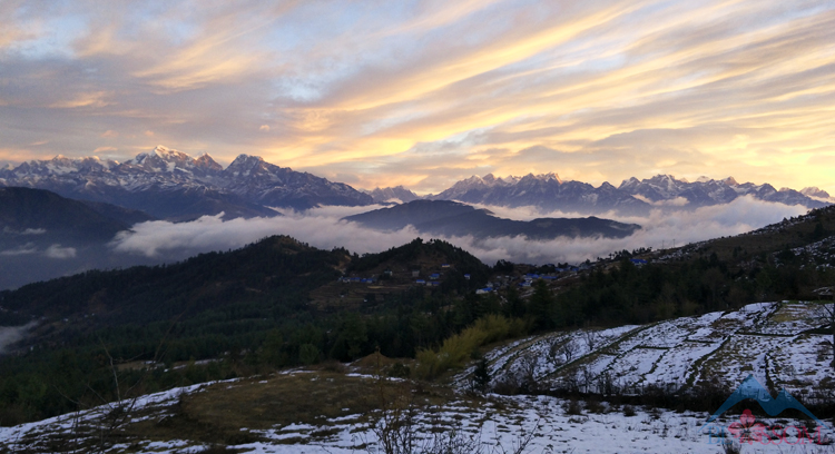
We stopped at Dhap to take some pictures. Pikey Peak was quite impressive this morning. The dry grey color had turned into a white mountain, because of last night’s snowfall. After taking some photos, we drove to Thade Bazzar and stopped there for breakfast. Afterward, we continued to drive to Kathmandu and ended our wonderful trek with happiness and satisfaction.
Thank you for taking the time to read this article. I hope you found it informative and that you’ll consider visiting this spectacular place in the future. If you’re planning a trek to Pikey Peak and need assistance, please don’t hesitate to contact me, Ambar Tamang, at Blossom Expeditions.
Written By: Ambar Tamang
Founder/Guide: Blossom Expeditions
P. O. Box No: 21101, Kapan-12, Kathmandu, Nepal.
Telephone: 977-01-4810388
Mobile: 977-9851123762
WhatsApp/Viber: 977-9841454462
Email: blossomexpeditions@gmail.com
www.blossomexpeditions.com
YouTube Video
Pikey Peak Trekking Package
Introduction to the Nagarkot Day Tour Most of the Nagarkot 1-day tours we organize are truly unforgettable. Located at an altitude of 1,930 meters above sea level, Nagarkot is a popular tourist destination near Kathmandu city. From this hilltop, you can enjoy breathtaking sunrises and spectacular views of the majestic Himalayas, including Mount Everest. The surroundin...
An Unforgettable Journey Through Nepal’s Majestic Himalayas Experience the best of Nepal with a unique trek combining the famous Annapurna Base Camp and the peaceful Khopra Danda, popularly known Khayar Lake Trek. Discover stunning mountains, local culture, and hidden trails. In late November 2024, we went on an amazing adventure in the heart of Nepal's Himalayas. ...
A Journey into Nepal’s Hidden Paradise Our trip to Jumla and Rara Lake in 2024 was an incredible adventure into a really beautiful and remote part of Nepal. Rara Lake, the biggest freshwater lake, is located in the far northwest of Nepal, surrounded by green forests, mountains, and amazing scen...
Comments